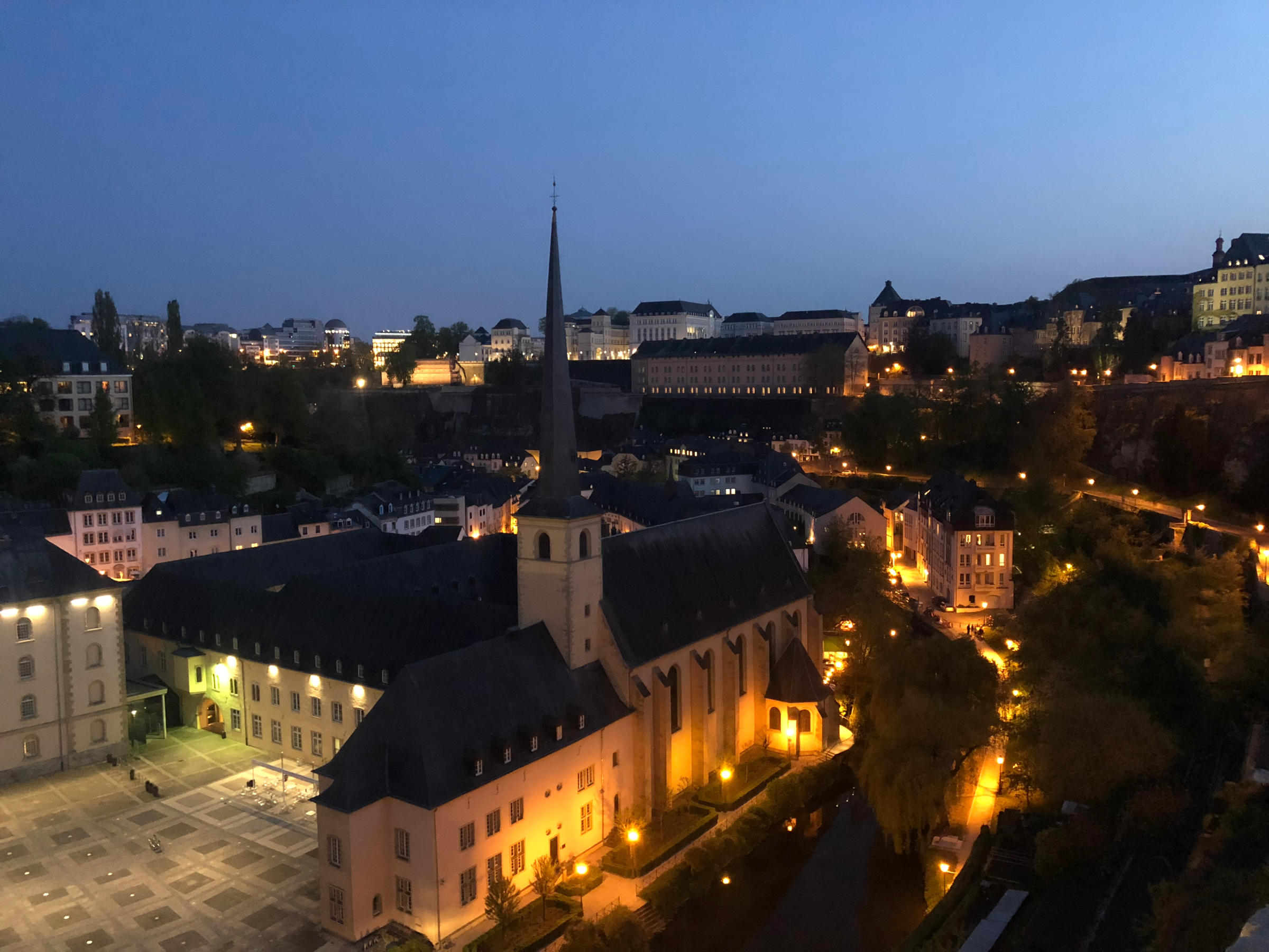
Luxembourg is a deceptive city. The differences between its layout on a grid versus the geographical reality you will find there are vast. Never has cartography proven more ineffectual. The city’s area is not very large on paper, and by simply glancing at a map, you could wildly underestimate the time and ease with which it will take you to get from Point A to Point B. More helpful would be a topological diagram to impress upon you just how dramatic the peaks and valleys of the capital truly are. Jaw-dropping beauty abounds, but don’t expect to experience it without some hardcore physical exertion. I will attempt to explain Luxembourg City’s unique geography by taking you on a tour of the Ville-Haute (Upper Town), the Bock Casemates and three of the “lower” quarters known as Grund, Clausen and Pfaffenthal.
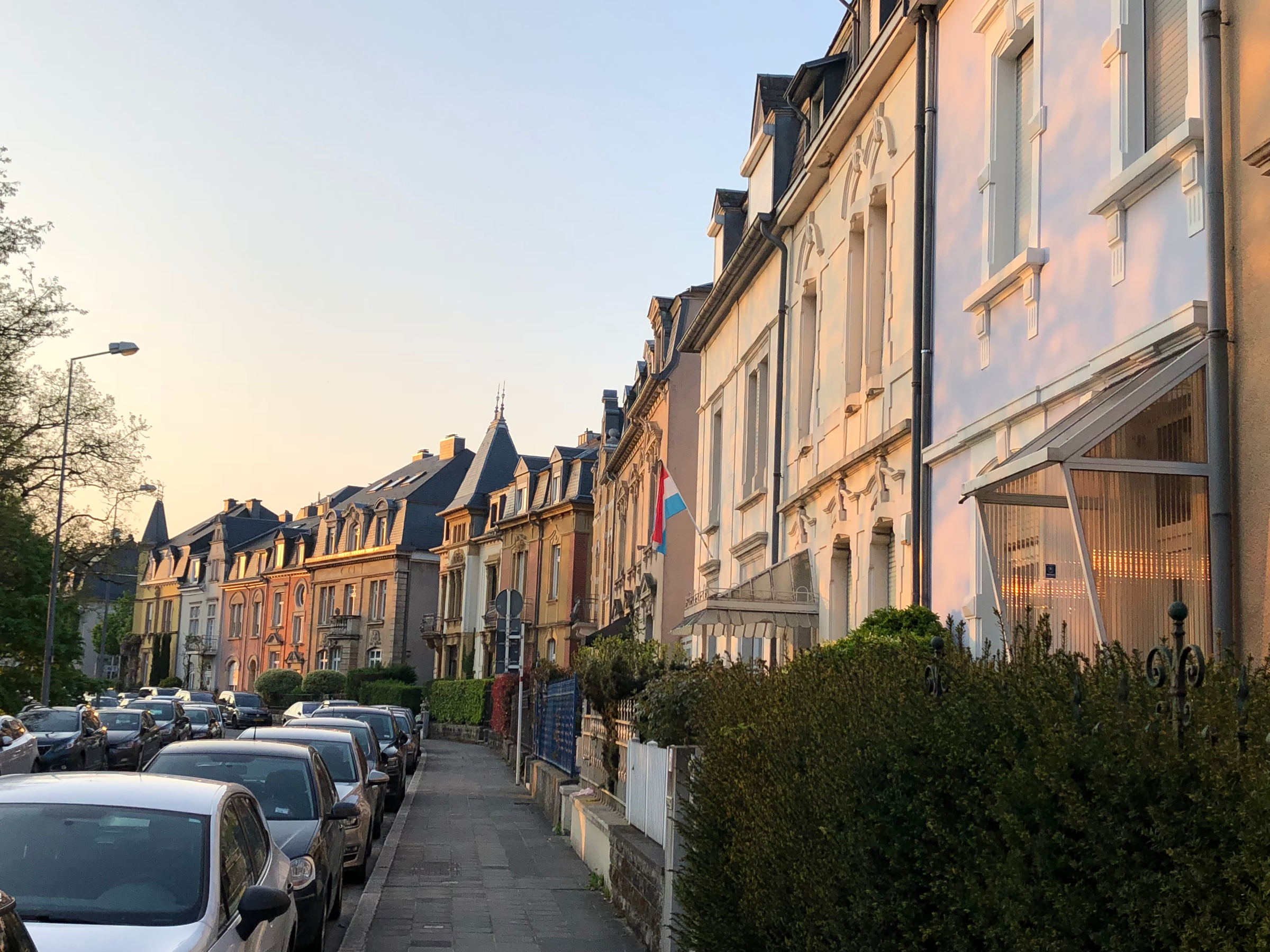
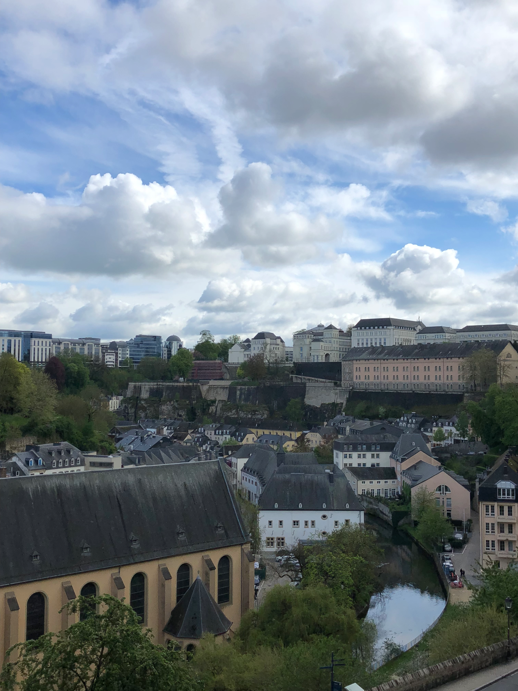
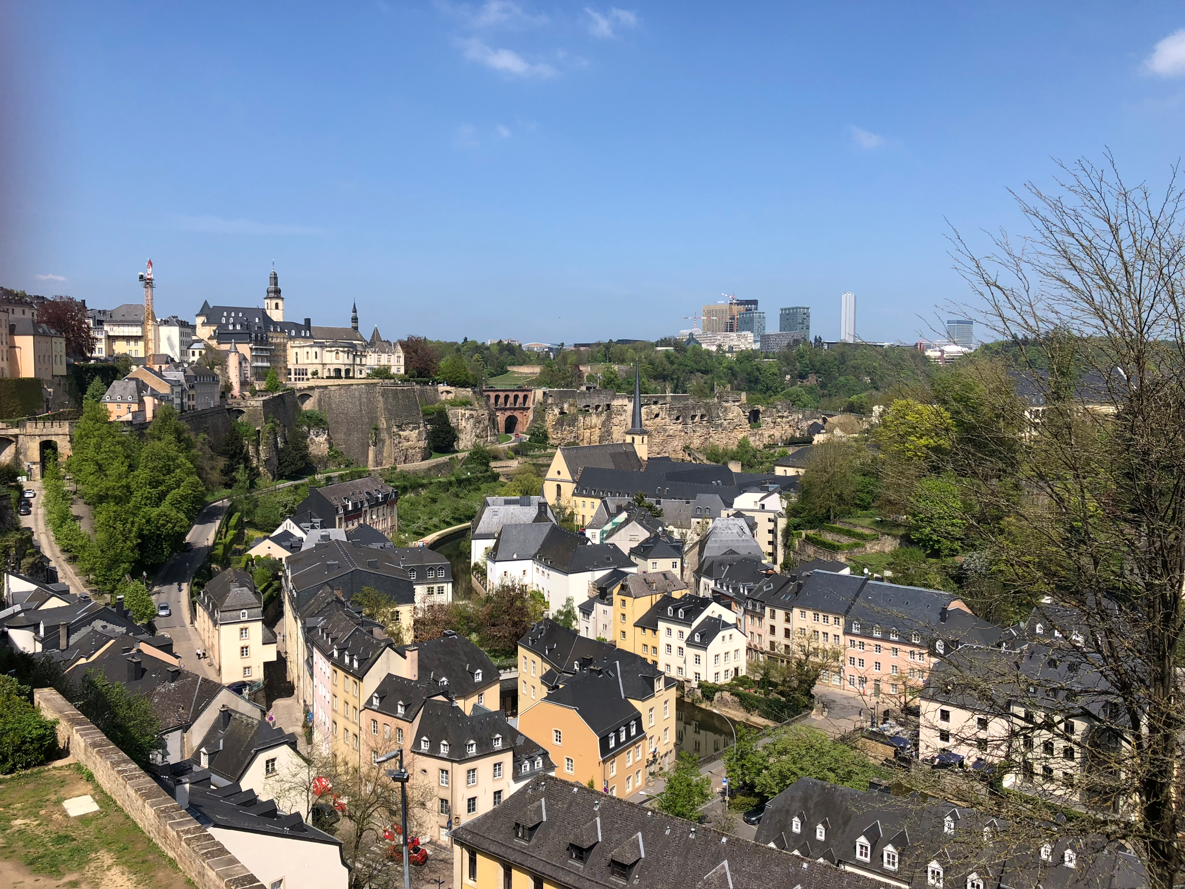
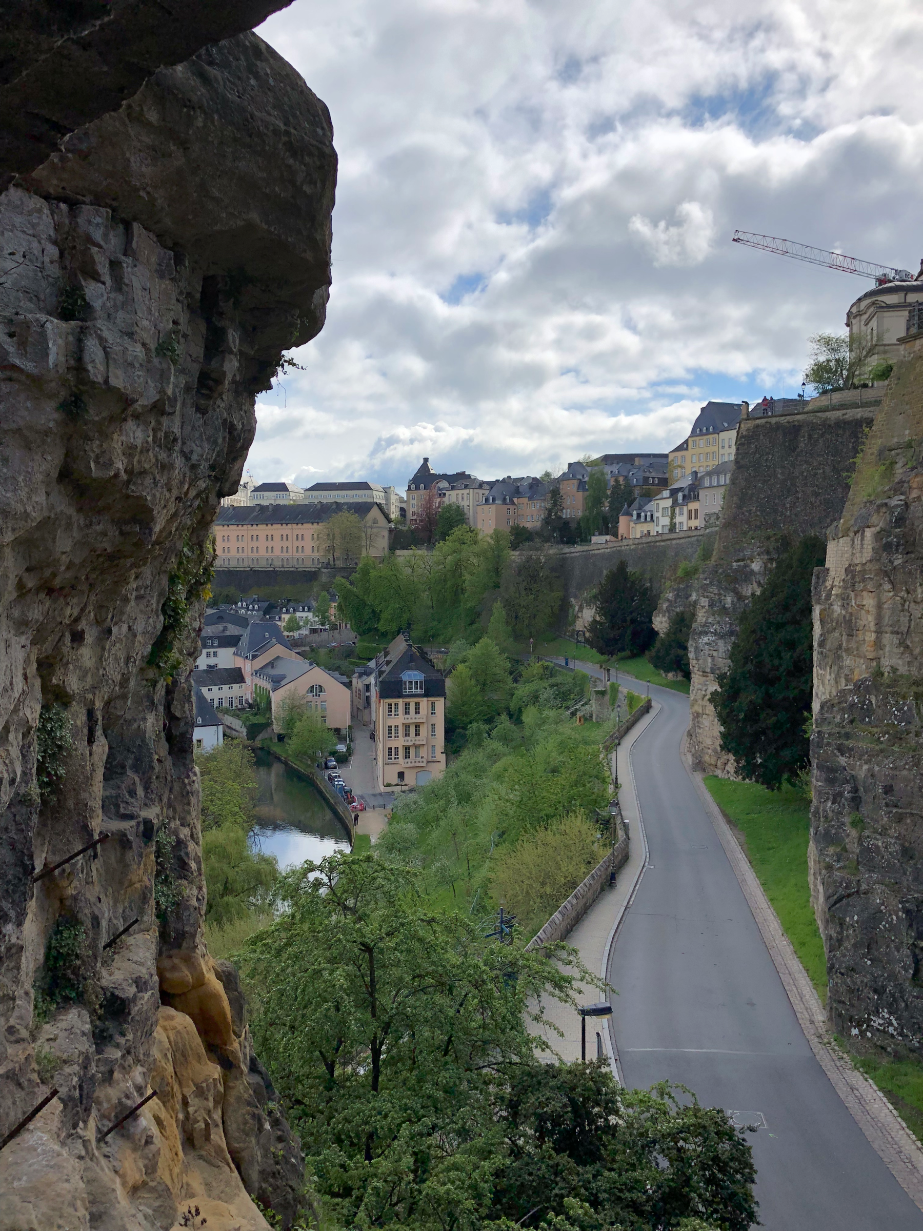
Many cities are built on the banks of a water source, or even at the confluence of two rivers, but few locales offer such staggering settings on which to build a capital city as the Pétrusse and Alzette River Valleys. On a map, the Pétrusse and Alzette Rivers appear to be nothing more than roiling streams, meandering through the area, and actually that’s a pretty accurate description. Neither river is very powerful or about to power some hydroelectric dam, but what both currents lack in might, they make up for with their geographical placement deep inside two valleys. The cliffs on either side of these massive, forested canyons rise up 70m (230ft) from the river beds and they stretch wide enough to accommodate thousands of residents who choose to live down below the Ville-Haute.
The plateaus created by the intersecting gorges are connected by various bridges and spectacular winding pathways that guide you up and down the valley walls. There are also two elevators that connect the Upper Town with both the Grund and Pfaffenthal districts below. In the middle of the “V” created by the confluence, rests the Ville-Haute; to the South sits the Gare district, where (obviously) the train station is located; the easterly plateau, known as Kirchberg, is the most modern area of the capital, home to many of the world banks and EU institutions that employ the city’s denizens. The ancient fortress built along the high ridges created by the river valleys, known as the Bock, rests in ruin, looking out over the lower quarters. The Ville-Haute, Bock Casemates, Grund, Clausen and Pfaffenthal neighborhoods are all included in Luxembourg’s UNESCO declaration from 1994.
Place d’Armes (Plëss d’Arem or simply Plëss)
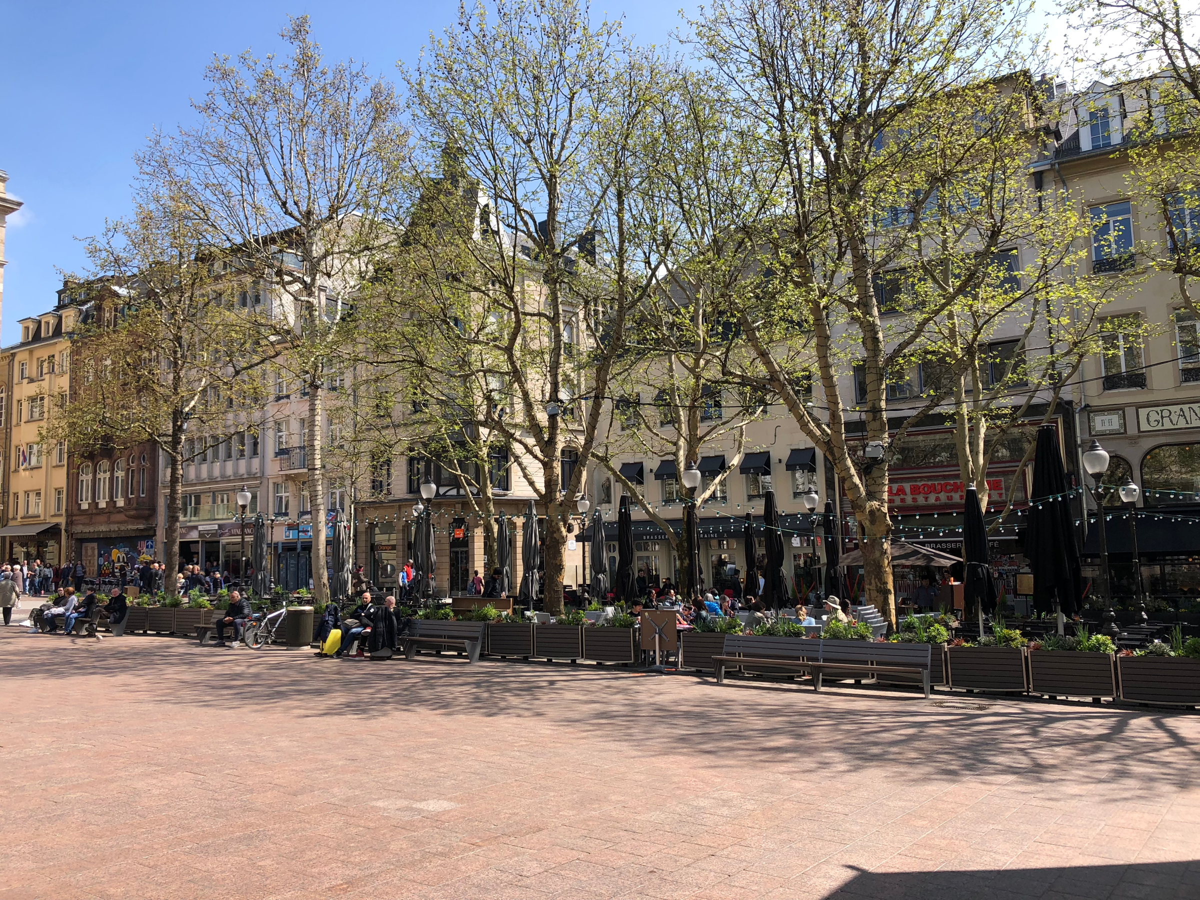
The heart of the Ville-Haute, Place d’Armes, or Plëss as it’s slangily referred to in Luxembourgish, is a quaint central square lined with chic restaurants and whose side streets have sprouted into tendrils of pedestrianized lanes, creating the city’s posh shopping district. Twice a month, a flea market is held at Plëss and in the winter this is the site of the Luxembourg Christmas Market. On warm evenings, jazz bands provide live music for the diners and it’s all a bit of a European fairy tale for the well-heeled traveler.
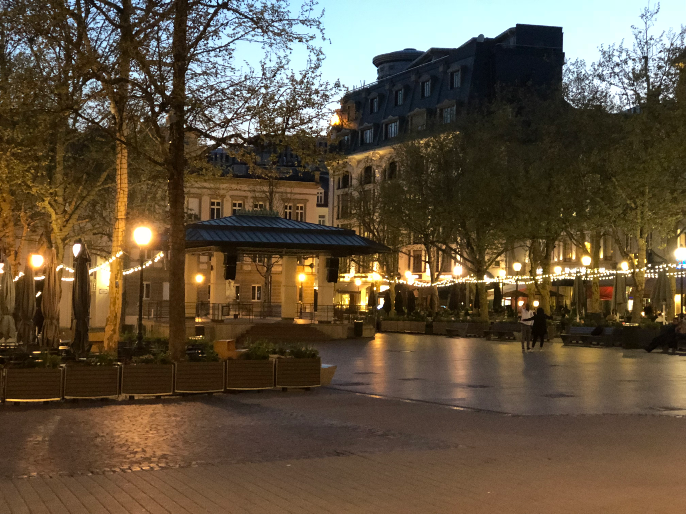
Of course, Plëss represents everything that’s wrong with visiting Luxembourg for the budget traveler: bistros to bust any budget and designer boutiques that feed into the stereotype that everyone in the Grand Duchy is a snobby elitist. What’s more, with guidebooks like Lonely Planet and even Rough Guides placing Place d’Armes as the first “must-see” attraction on the list, it gives the false impression that there’s nothing more to Luxembourg than fancy food and haute couture. Lonely Planet goes so far as to boast that one could spend hours wandering around the shopping district. Hours? Try five minutes. As pretty as it is, don’t let a trip to Plëss lead you to believe that this is all that the capital has to offer.
Palais Grand-Ducal/Groussherzogleche Palais (Royal Palace of the Grand Dukes)
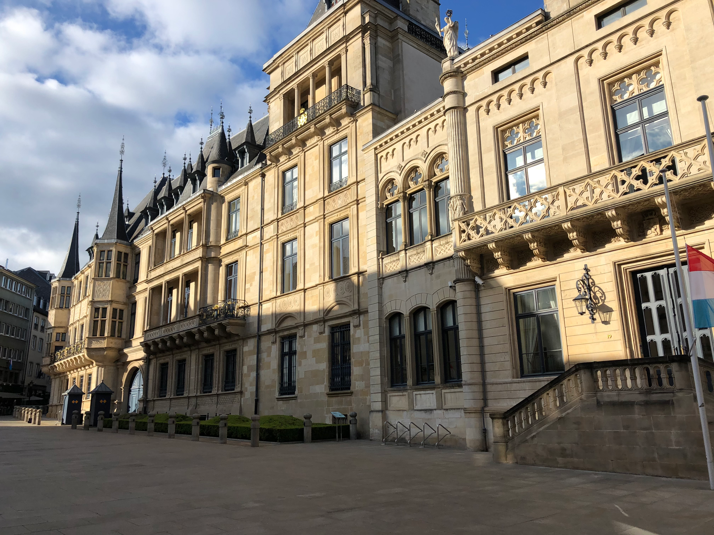
The Palais Grand-Ducal (Royal Palace of the Grand Dukes) lies a few streets over from Plëss. Although you can always get quite close to the exterior of the palace, the interior is only open to visitors for a few weeks in the summer by guided tour only. The building was constructed in 1572 and served as the Luxembourg Town Hall until Napoleon captured the city in 1795. After Luxembourg gained its independence in 1839, an extension was completed in 1859 to house the Luxembourg Parliament. When the Luxembourg royal lineage broke with the Dutch monarchy in 1890, the palace became the official residence of the newly-crowned Duke and Duchess. During World War II, the Nazis draped the facade in swastika flags and made off with much of the art and original furniture that had been in the palace for centuries. After a post-war refurbishment has allegedly restored its halls to their former glory, I can’t verify this fact as I visited in the spring and missed out on the tour.
Marché-aux-poissons/Fëschmaart (Fish Market)
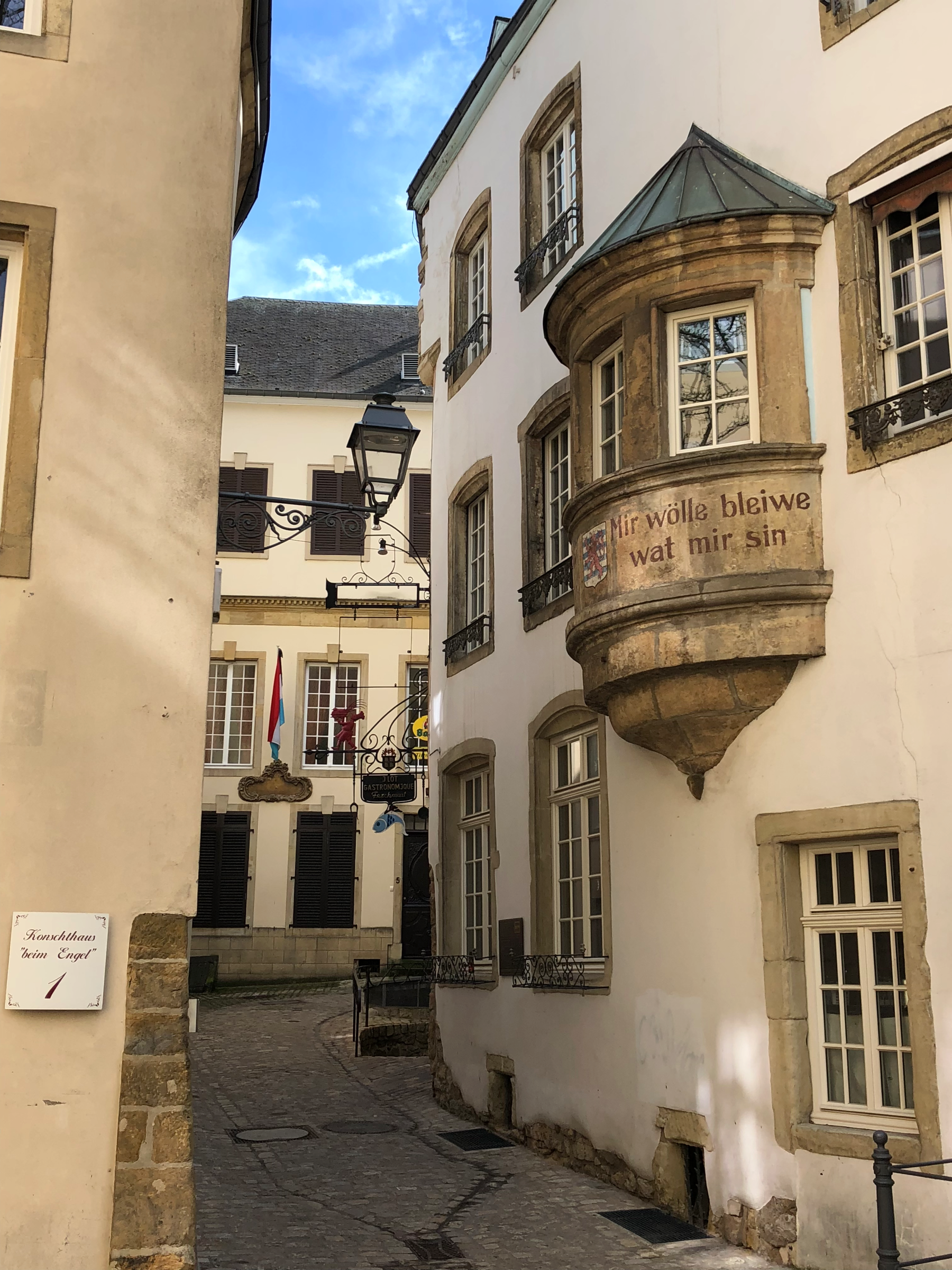
In medieval times, Place d’Armes was used for running military drills (hence the name) and didn’t function as the main gathering spot that it does now. Acting in that capacity was the Marché-aux-poissons (Fish Market) that was the economic and social center for the citizens of Luxembourg. You’ll note the National Motto, “Mir wölle bleiwe wat mir sin” (We want to stay what we are) is painted for all who enter the square to see.
Pont Adolphe/Adolphe-Bréck (Adolphe Bridge)
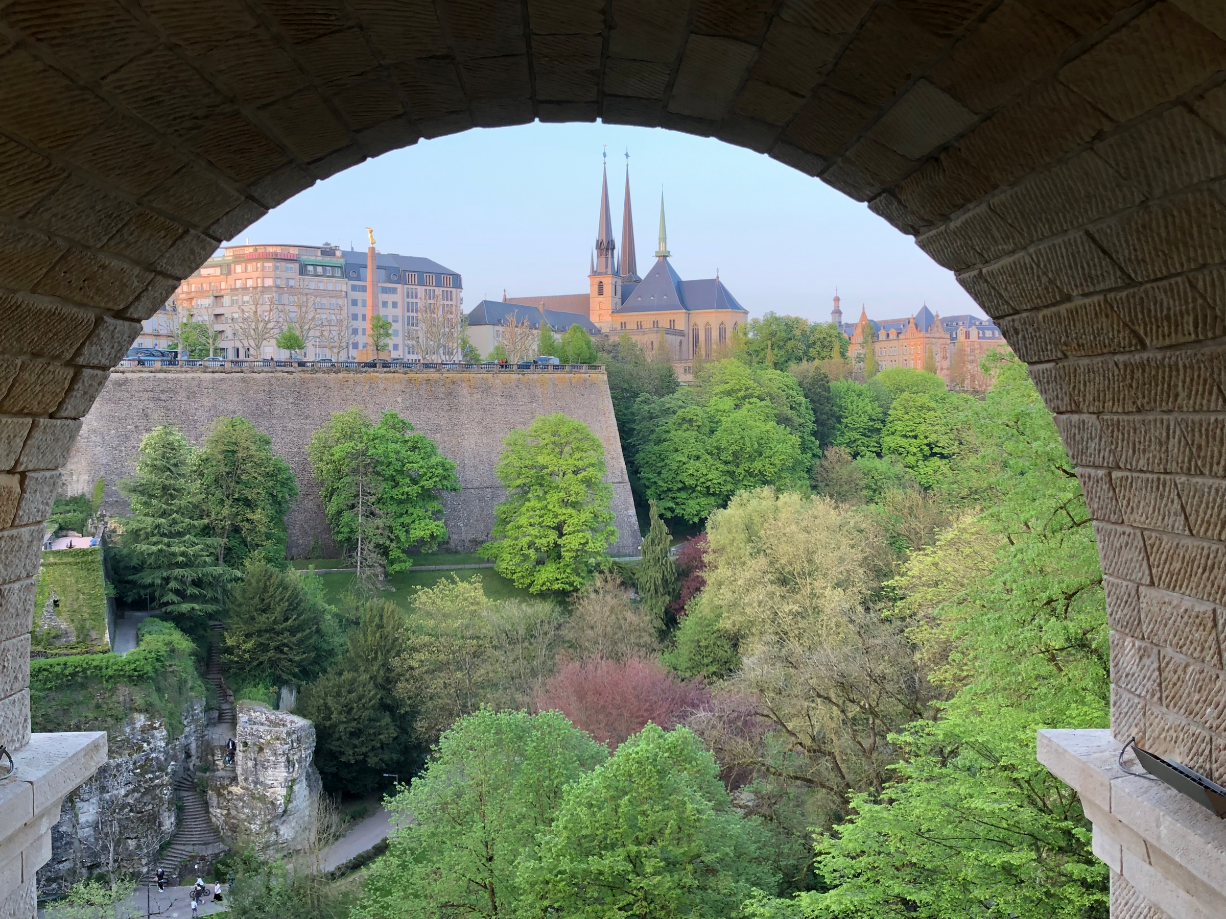
I booked an Airbnb in the Gare neighborhood for my stay; I had to cross the grand Pont Adolphe (Adolphe Bridge) every morning as I made my way to the Ville-Haute. This mammoth bridge spanning the Pétrusse Valley is comprised of two levels (an upper for traffic and a lower for walkers/bikers) with periodic arches that make for excellent photographs of the Pétrusse’s foliage climbing up the walls of the Ville-Haute. Here you can see the golden Gëlle Fra and the Gothic Cathédrale Notre-Dame/Kathedral Notre-Dame along the morning skyline.
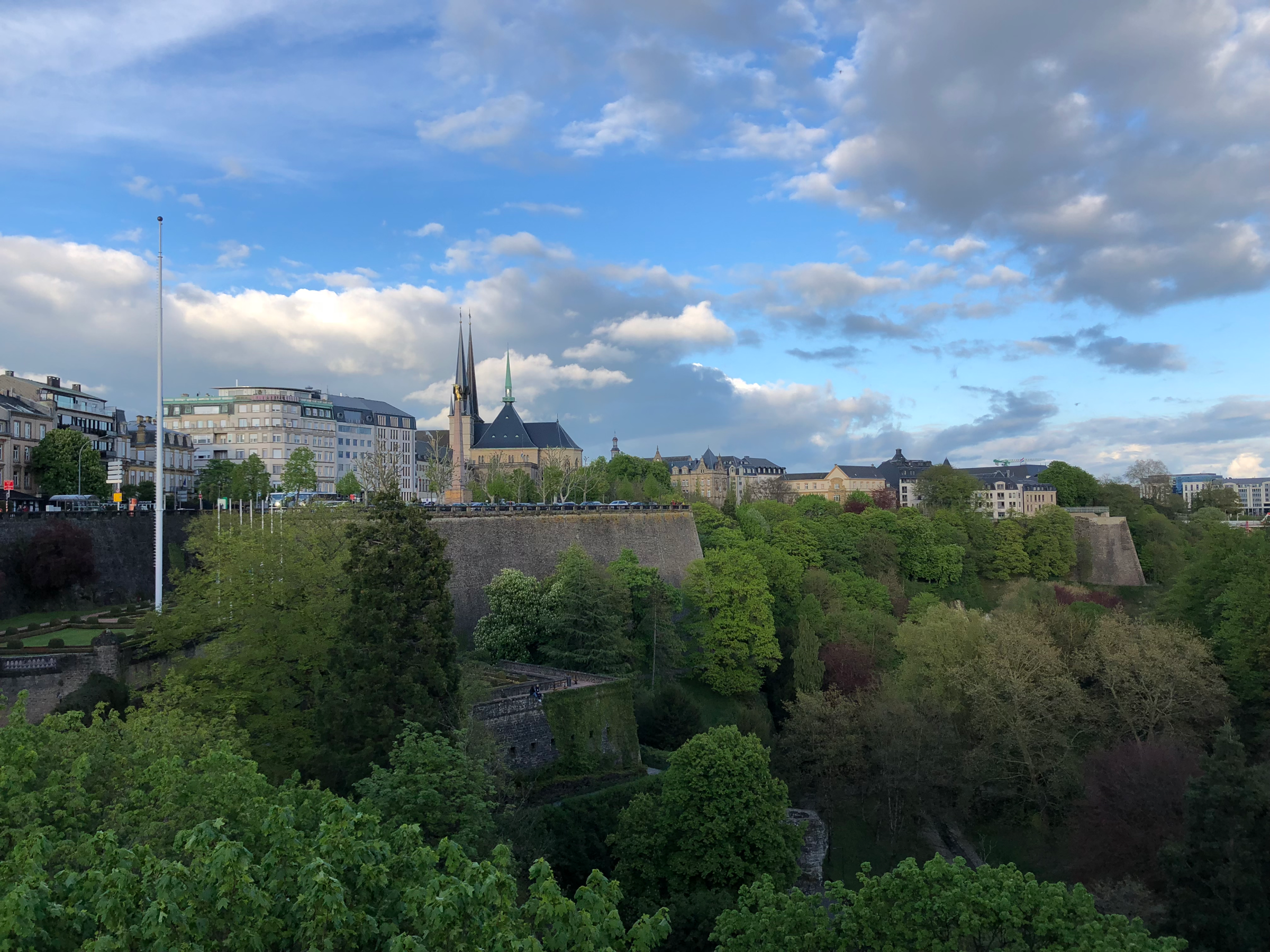
The bridge, which was completed in 1903, was named after Grand Duke Adolphe, who ruled Luxembourg from 1890-1905. Originally the bridge was only one level; the lower suspension level for pedestrians wasn‘t added until the 21st Century. The Pont Adolphe stretches 153m (502ft) across the canyon and looking down will treat you to a 42m (138ft) drop. All this is to say that unless you‘re prepared to hike up and down the valley walls each time you want to get somewhere, if you‘re afraid of heights, you better get over it and fast. Crisscrossing from the Gare to the Ville-Haute to Kirchberg over Grund, Clausen and Pfaffenthal is going to involve a lot of high-wire antics.
Pétrusse Valley & Spuerkeess
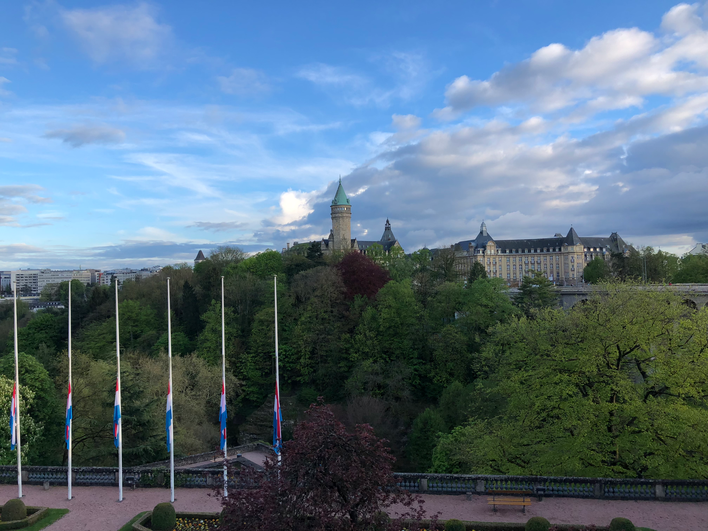
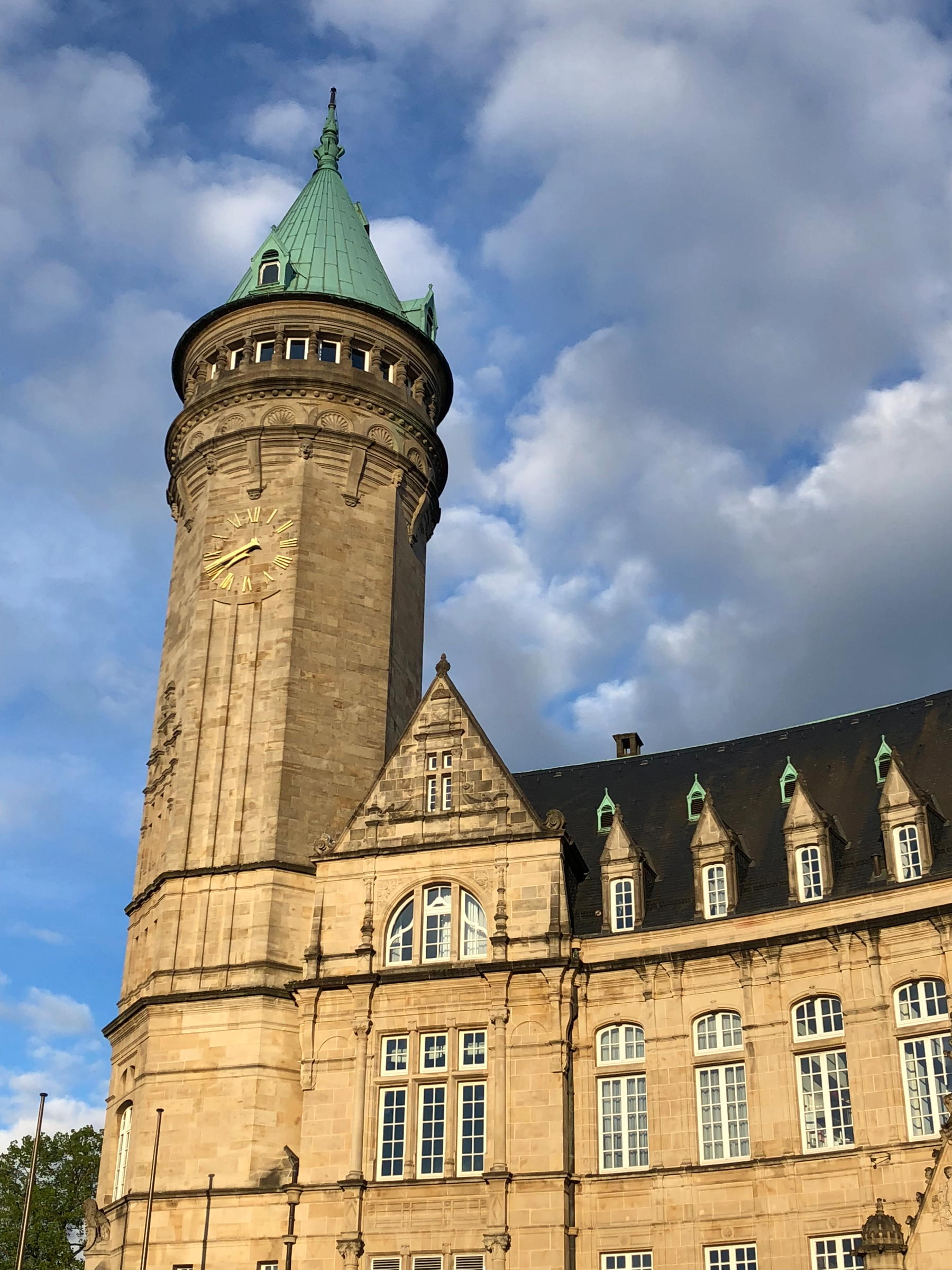
It’s a palace! It’s a castle! It’s a…bank? Yes, that beautiful Neo-Renaissance tower jutting up from the cliffs along the Pétrusse Valley belongs to Spuerkeess, Luxembourg’s official state bank and the oldest financial institution in the Grand Duchy. After independence, Luxembourg planted the seeds of its economic reliance on banking by establishing Spuerkeess in 1856. The bank grew so large that a new building was commissioned from the architect Jean-Pierre Koenig, who designed it in a Neo-Renaissance style. Part of the bank has been turned into a numismatic museum, which I opted out of visiting; climbing the tower is off limits.
The Bock Casemates
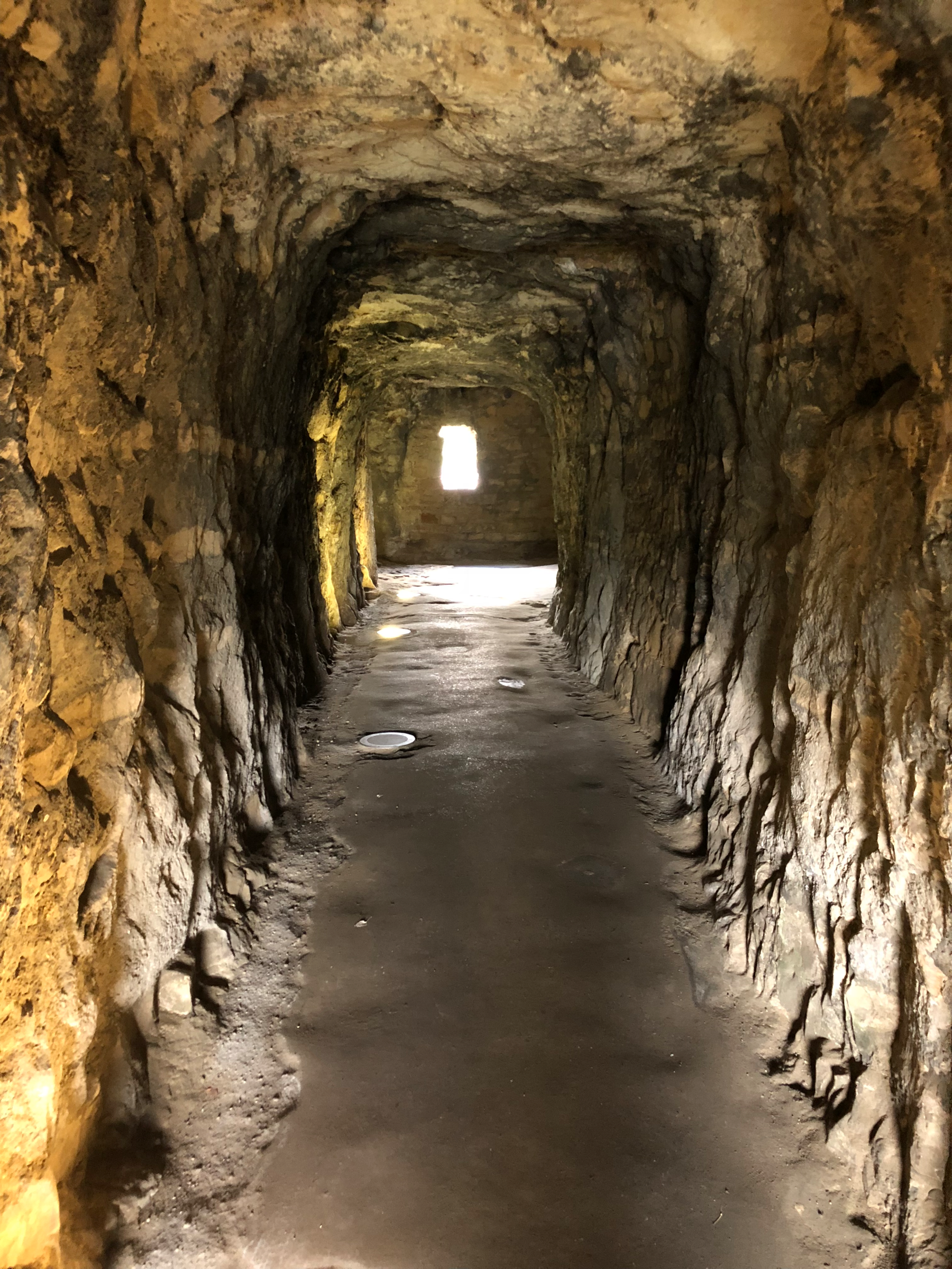
Count Siegfried, the first Grand Duke of Luxembourg, built his castle along the ridges of the Ville-Haute that overlook the Alzette Valley. Officially called Bockfiels and nicknamed “The Bock” (meaning The Rock), the fortifications were greatly expanded by John the Blind in 1340 and continued to protect the city until 1867 when the Treaty of London forced the Grand Duchy to dismantle their defenses. The Casemates are an underground series of tunnels and artillery holding rooms, burrowing underneath The Bock’s bedrock. Their construction began in 1644 when Luxembourg was part of the Spanish Netherlands. In total, 23km (14 miles) of tunnels descend 40m (131 ft) into the cliff, of which several kilometers are still accessible to the public today.
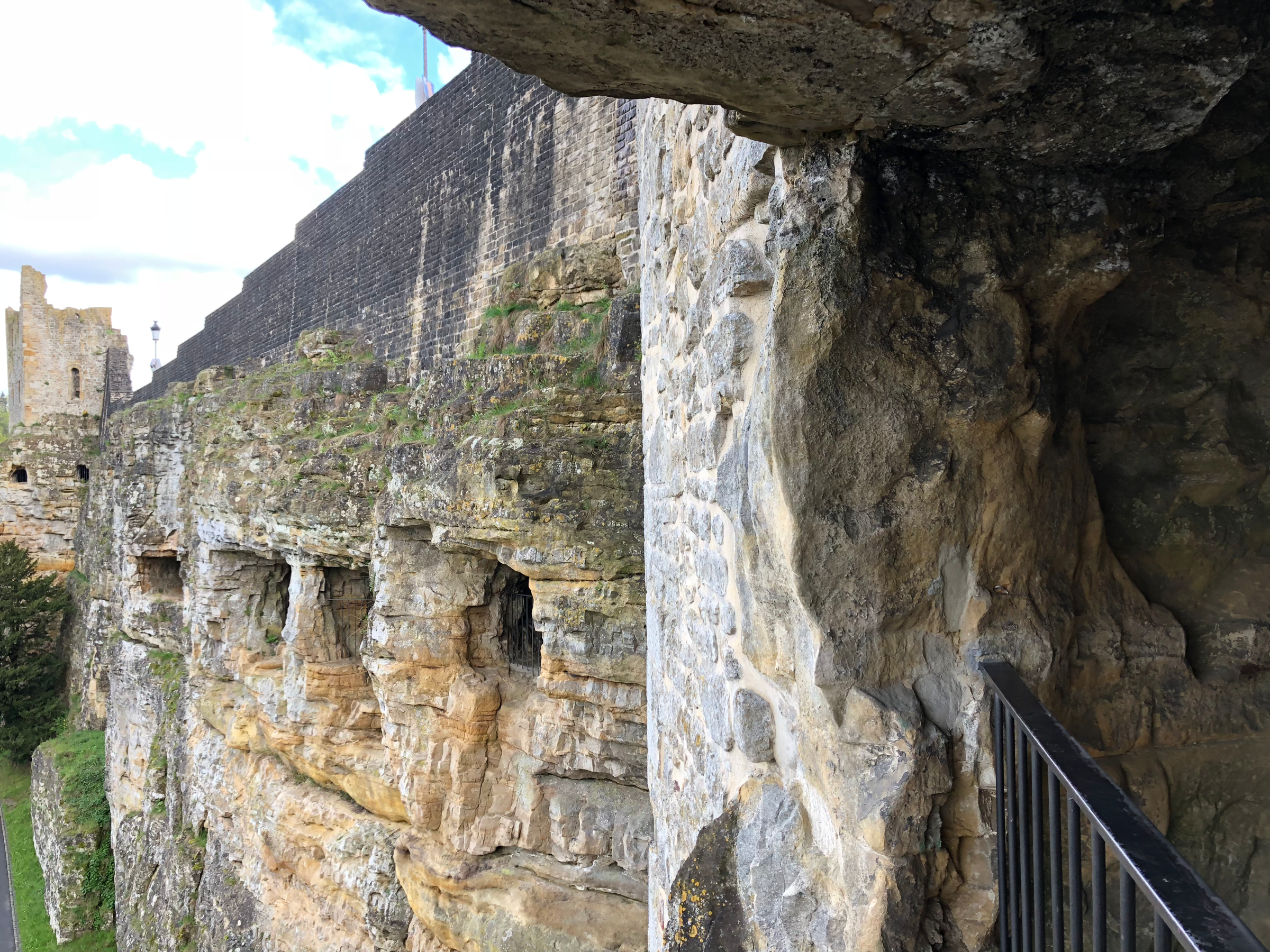
A cannon was positioned through each opening along the Casemates tunnels. If invaders managed to evade the cannonballs and bullets lobbed their way, Luxembourgish soldiers would pour hot oil on their assailants once they reached the Bock’s walls. In 1794, Luxembourg held out against Napoleon’s army for seven months, capitulating only due to lack of food left in the castle. Because of this, the French army bestowed the sobriquet “The Gibraltar of the North” on The Bock, which still endures to this day.
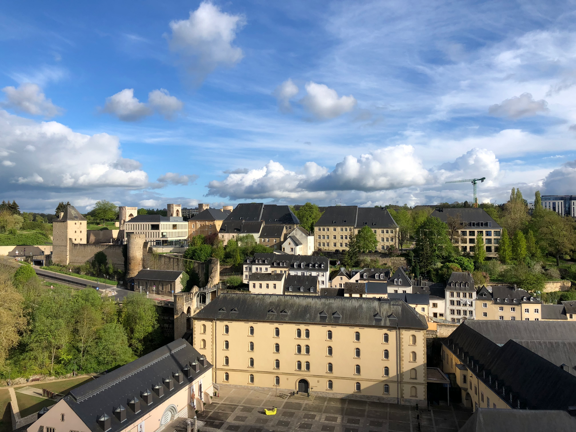
In the photo above, you can see the Huelen Zant/Dent Creuse (Hollow Tooth) in the far left of the frame. This fragment of a tower is one of the few pieces of the old castle that wasn’t completely torn apart after 1867. The entire dismantlement took sixteen years, and yes, it was a great historical loss for the city, but ultimately the destruction of The Bock opened up the plateaued areas of the capital to new development and created space for residences and government buildings alike. The Bock was destroyed because Luxembourg’s neighbors feared its defensive might, but it ended up helping the city advance in the long run. There is always a bittersweet balance between preservation and progress as a city continues to evolve.
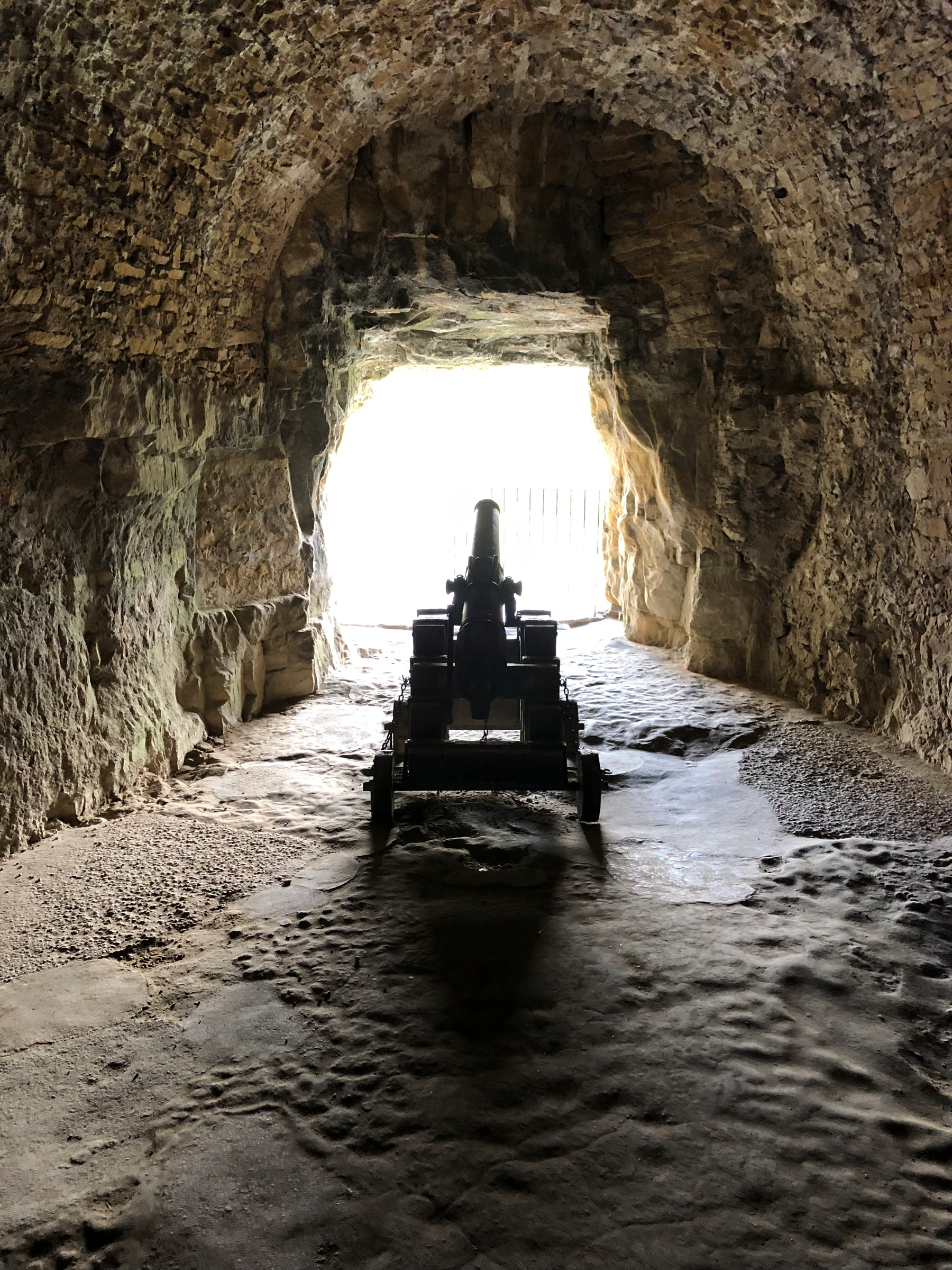
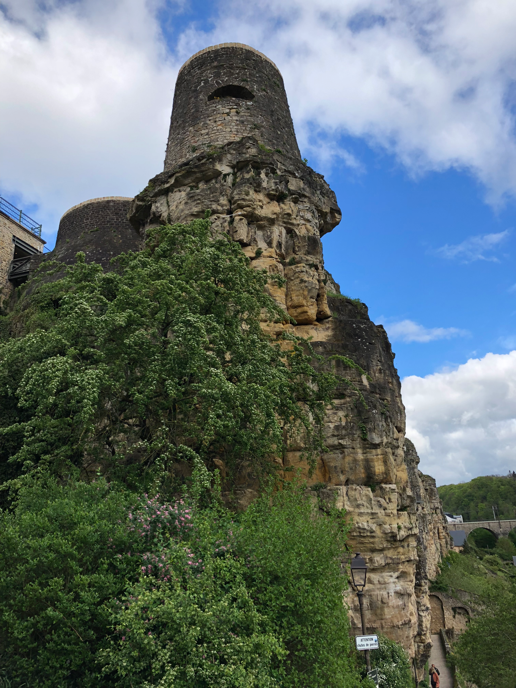
The Bock is also steeped in lore and legend, mostly centering around Count Siegfried’s wife, Melusina. As the story goes, Siegfried and Melusina were in love, but she had one demand of her husband: he was not to see her for one day and one night each week when she locked herself away in a tower of the castle. One night, Siegfried’s curiosity got the better of him and he peered through the keyhole to discover that Melusina had grown the tail of a mermaid. Upon the discovery of her transformation, Melusina lept from the window and dove into the Alzette River below where she was seen for centuries after, swimming around the fort and protecting its soldiers.
Pont du Château
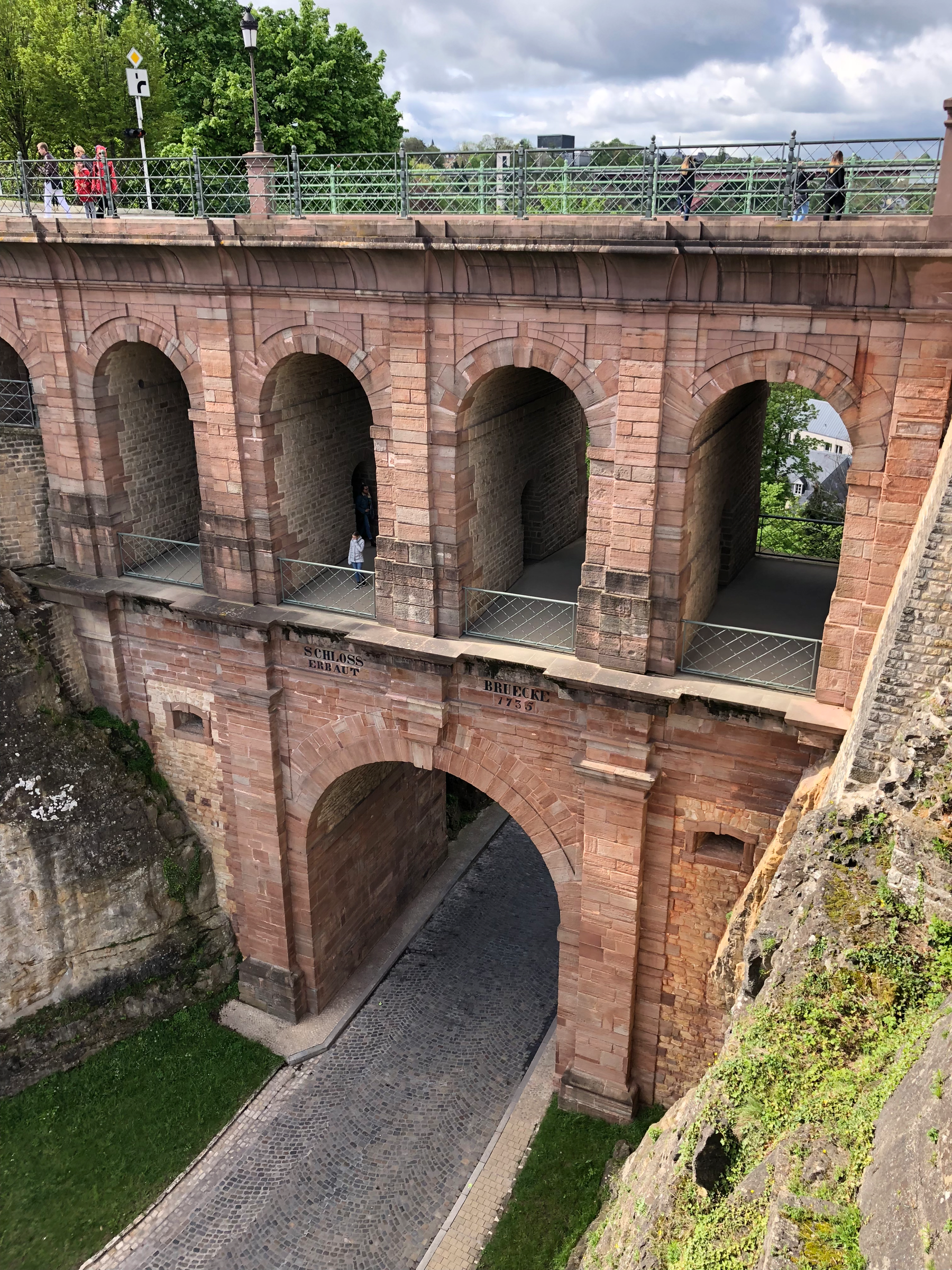
Built during Luxembourg’s Austrian occupation in 1735, the Pont du Château is a distinctive red brick bridge that connects the Ville-Haute to the craggy outcrop of the Bock Casemates. The bridge might not seem like much to look at, but, as so often is the case, appearances prove to be deceiving. Nestled and woven into the Pont du Château are no less than five ways for people to cross between the Casemates and the Ville-Haute. Spiral staircases and slim, secret passageways are disguised by the pillars, allowing Luxembourgers to slip between the two locations in secrecy. Access to the bridge is granted with your ticket to the Casemates, all of which is included with your purchase of the Luxembourg Card.
Batty Weber and the Chemin de la Corniche
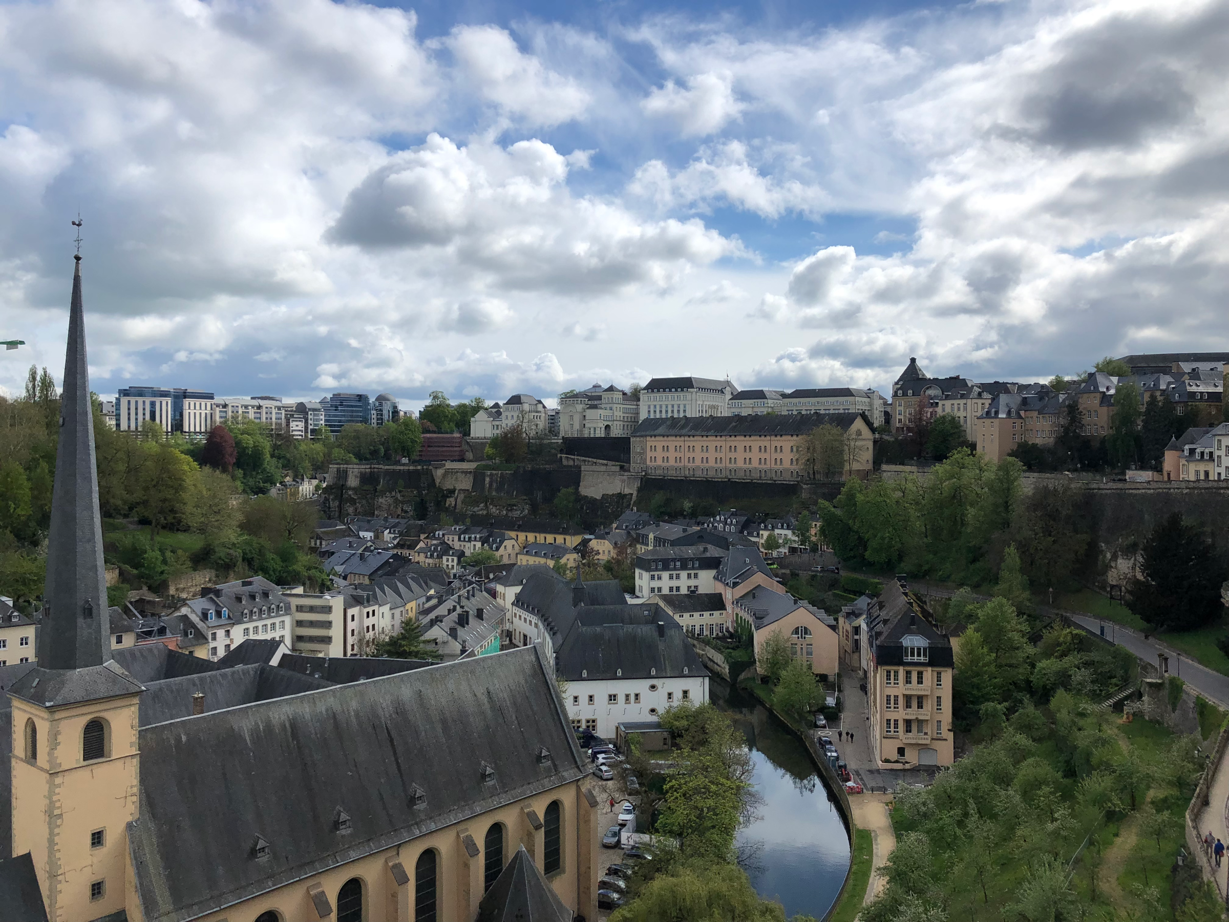
The Corniche is one of those “must-see” sights that lives up to the hype. It’s so beautiful to walk along, that even the most hardened and cynical traveler would surely be moved by its beauty. Following the city walls around the Alzette Valley, The Corniche was described by Batty Weber as “Europe’s Most Beautiful Balcony.” Weber, a native Luxembourger, is regarded as the country’s most-respected poet and playwright who published his works in Luxembourgish (as opposed to French or German). In 1913, Weber became editor-in-chief of the capital’s most prestigious newspaper and began writing a daily column titled “Abreisskalender,” which detailed some aspect of Luxembourgish culture, keeping the traditional alive until his death in 1940. Today the top literary honor in Luxembourg is known as the Batty Weber Prize.
The Vaughan and Wenzel Circuits
There are two main walking trails that will steer you through the former fortifications, past the Corniche and ultimately wind you through the three UNESCO neighborhoods of Grund, Clausen and Pfaffenthal. I scoffed when I saw that each circuit was estimated to take 2.5 hours. I’m a New Yorker. I walk quickly. There’s no way I’ll need the full 2.5 hours to complete each loop.
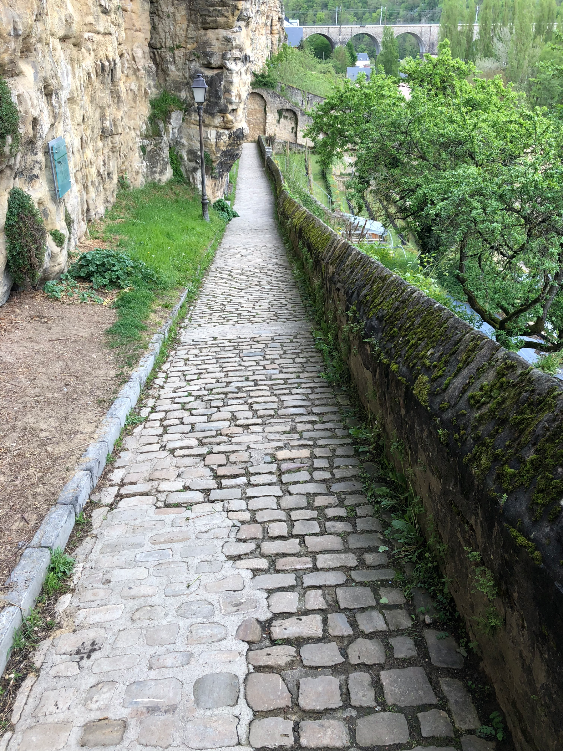
Well, I was wrong, and a couple different factors make the suggested time totally realistic. First of all, the walkways are mostly cobblestone, meaning that you have to watch where you’re stepping and you can’t be moving at a breakneck speed. Secondly, the paths aren’t flat. You’re trudging up and down the valley walls and what appears to be a few meters on the map is only accurate from a bird’s-eye view. The next stop on the circuit just might be 2m to the east and 80m below you. And lastly, there are a plethora of historical buildings and points of interest along with way, all well-marked with info placards. Unless you don’t care about learning about what you’re seeing, it’s going to take a minute to explore each new site.
Grund (Gronn)
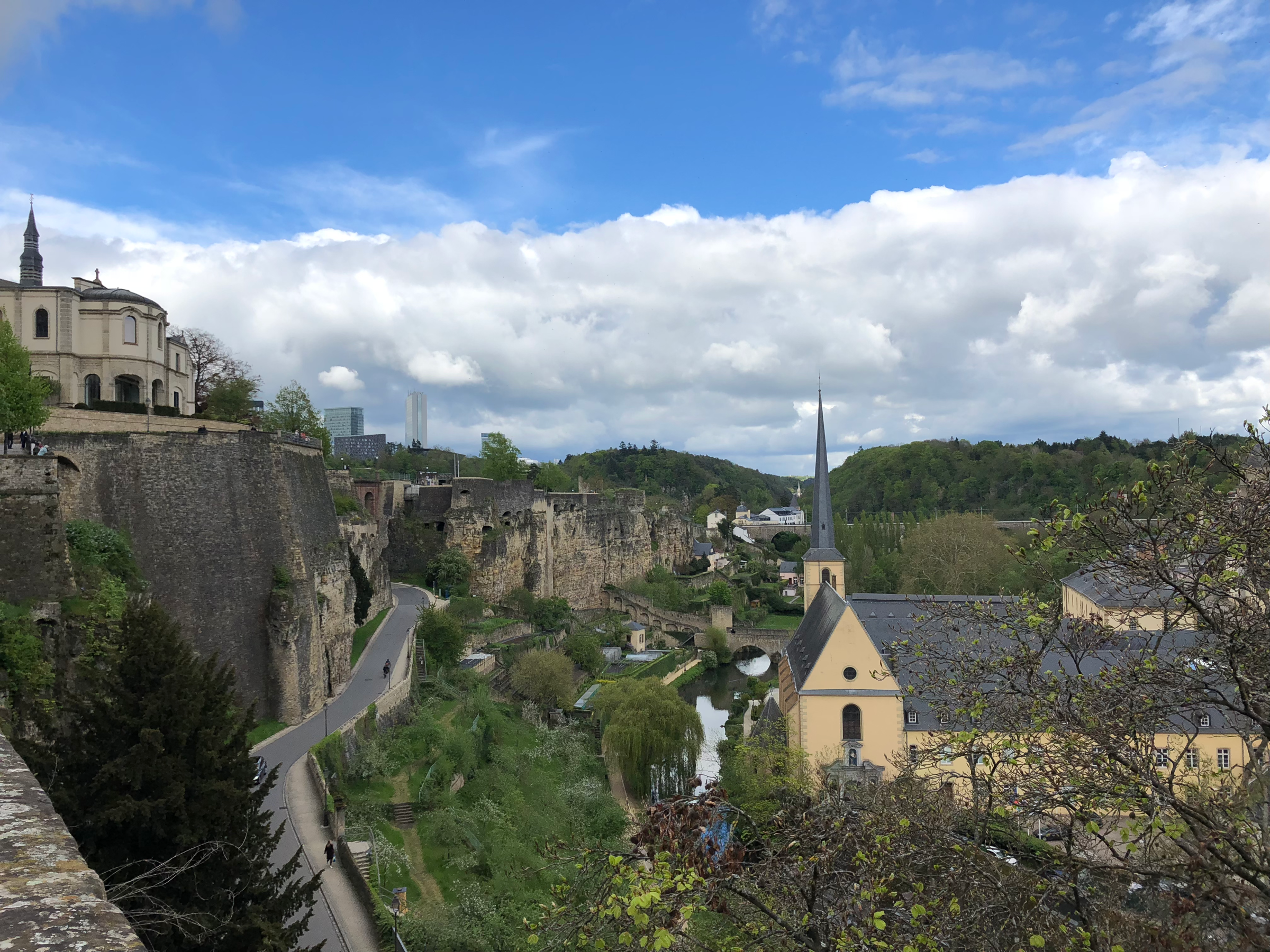
Given that Grund looks more like a movie set or open-air village museum than a lived-in city, I was shocked to learn that there are nearly 1000 people who call the quarter home. Still, there aren’t any schools in Grund or many other public amenities. You’ll mostly find restaurants and shops, plus the Natural History Museum is located in a former women’s prison along the Alzette River.
Grund used to be a working class neighborhood, full of tradesmen and artisans. They used the river to power their mills and aid blacksmiths and silversmiths with their craft. Over the past several decades, the area has gentrified and become one of the most expensive places to live in Luxembourg City.
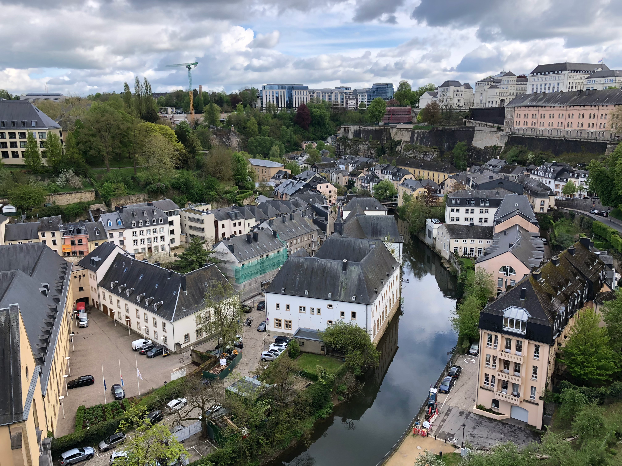
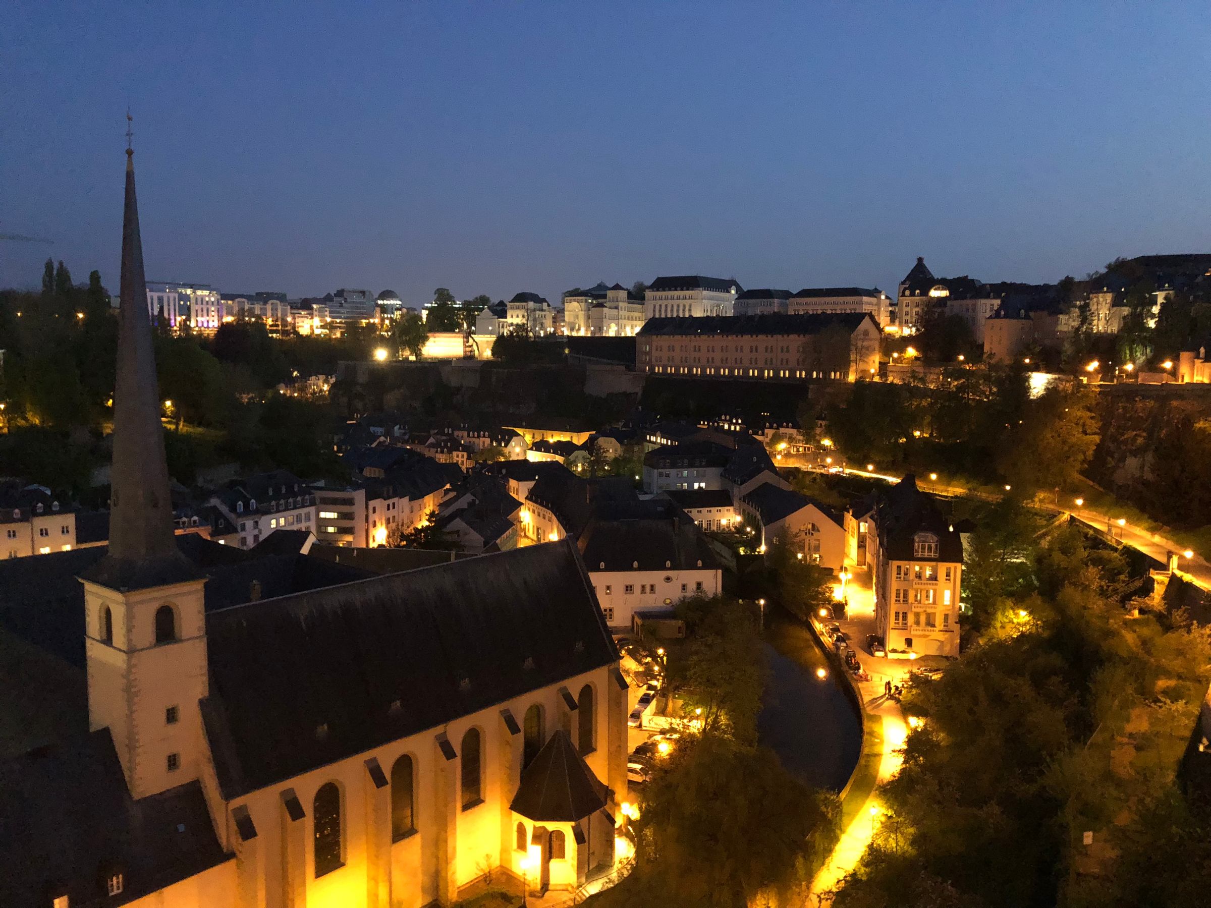
Two major tourist attractions can be found in Grund: Église Saint-Jean-du-Grund and Neimënster Abbey. Neimënster, with it’s can’t-miss-it courtyard, was built by Benedictine Monks in 1606. During Napoleon’s occupation, the abbey was turned into barracks to house his troops and later the former monks’ cells held prisoners instead. After undergoing a complete refurbishment, the former Abbey reopened in 2004 as a cultural center with rotating art exhibits, film nights and other assorted activities geared towards locals and tourists alike.
Église Saint-Jean-du-Grand was an addition to the abbey in 1688 and its spire has become one of the most recognizable symbols of the neighborhood. The baroque interior was a little much for my tastes, but if you had told me that Maria’s wedding to Captain Von Trapp in The Sound of Music had been filmed here, I would have believed you.
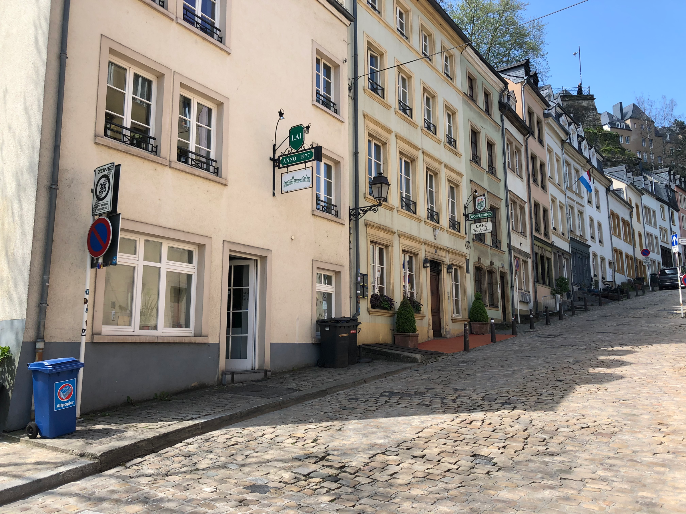
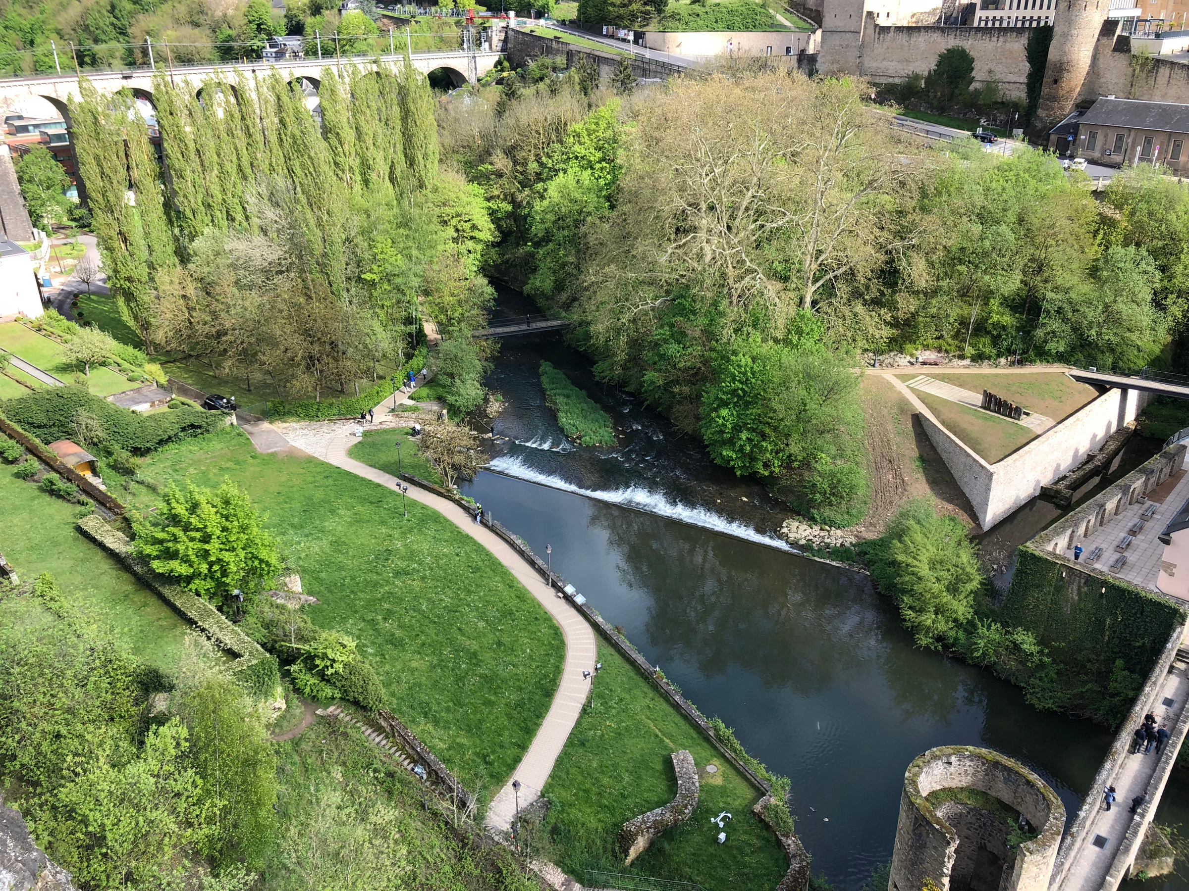
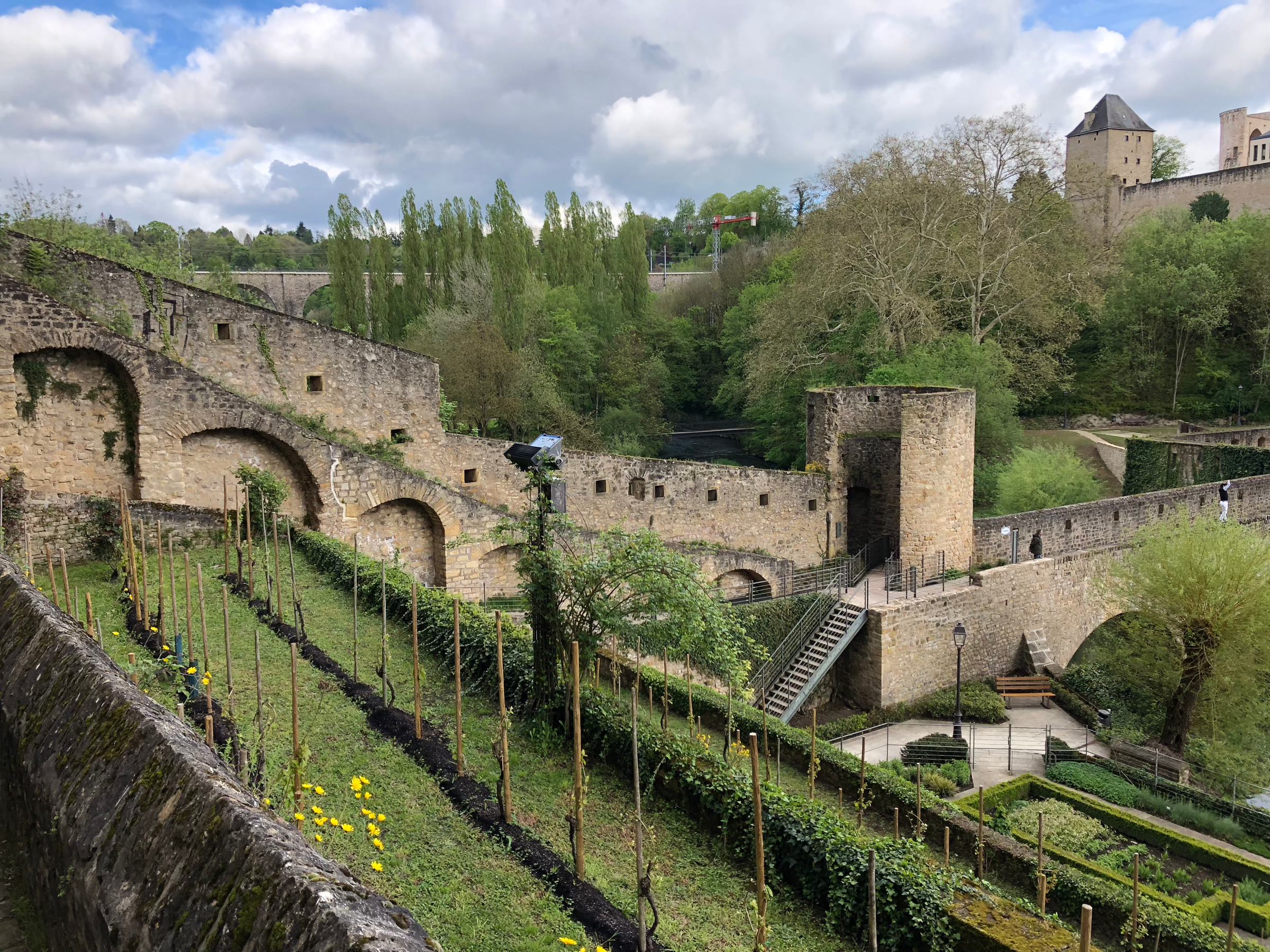
Grund, meaning the lower city, shouldn’t be confused with a flat city. Just because the district lies along the river basin doesn’t mean it isn’t full of its own set of hills, as evidenced by my photo above. I often joke with my dad that I need to train for my trips like one would train for a marathon, but it’s kind of true. If my iPhone step tracker is to be believed, I usually average 20-24km (12-15 miles) of walking each day. Luxembourg really did a number on my calves and I definitely earned each pint of beer I imbibed at night!
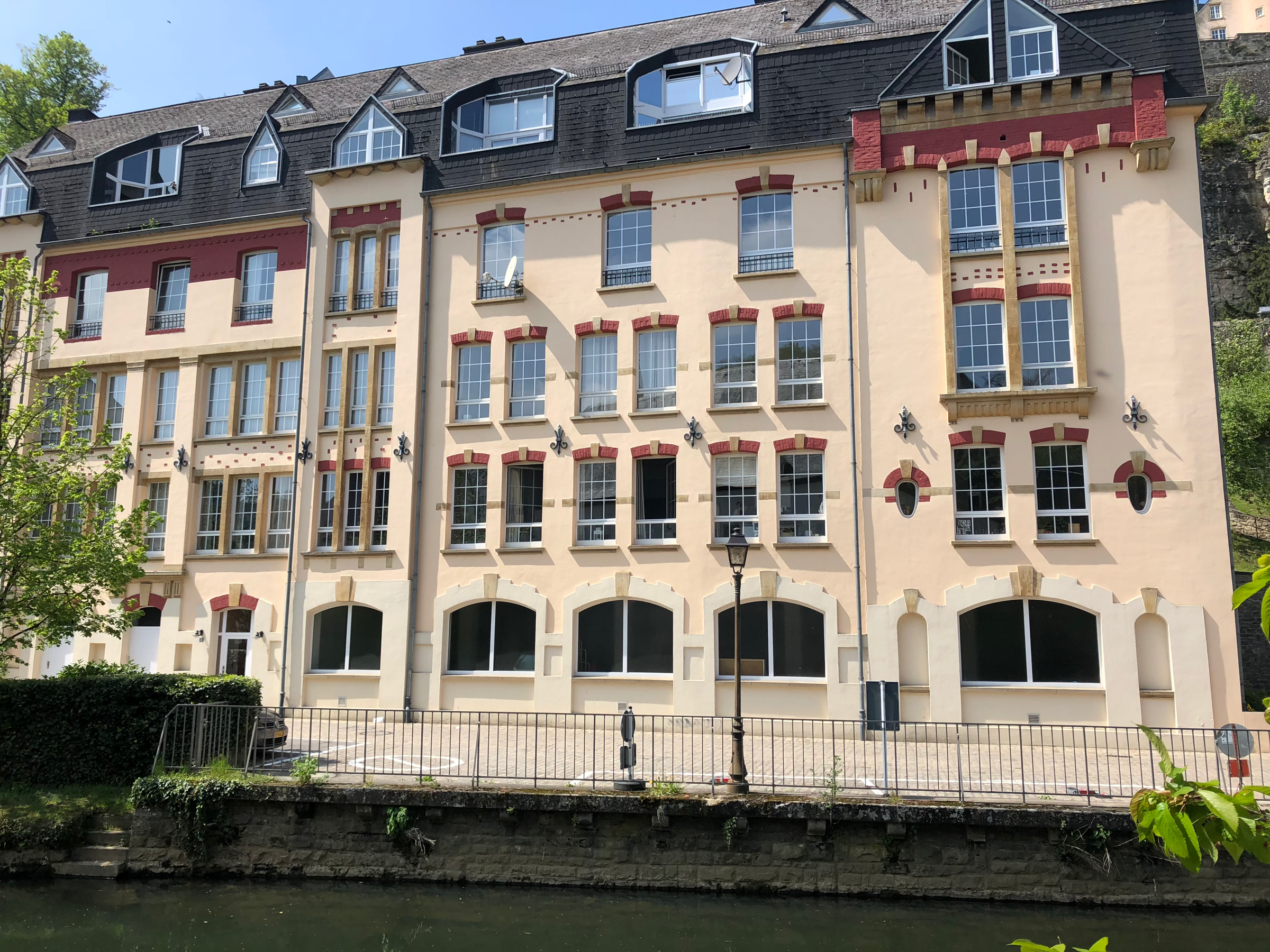
Grund isn’t completely pedestrianized, but traffic is strictly controlled and you can stroll the streets with safety and ease. Much scarier than the threat of traffic is the fear of flooding; plaques mark the heights to which the river rose in both 1756 and 1806, nearly washing away the neighborhood. Since then, significant improvements to the river drainage system have been implemented in an effort to circumvent future disasters.
Clausen
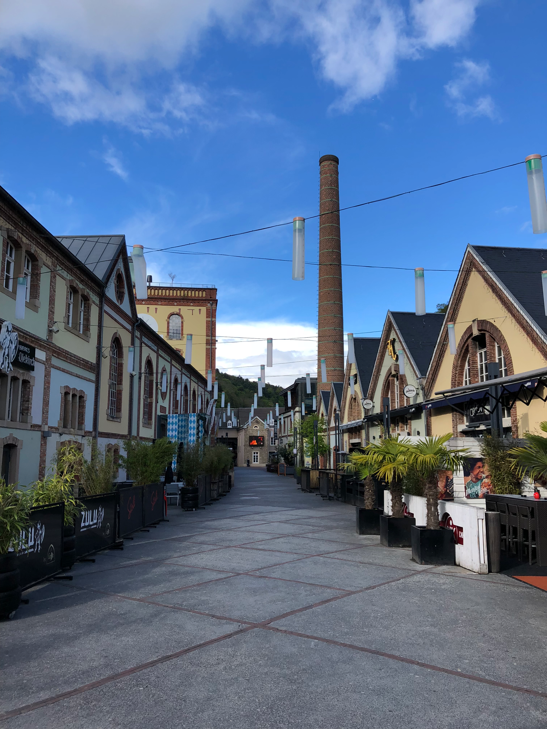
Continuing past Grund, you’ll come to the Clausen district, most famous for the Mousel Brewery, which has been in operation since 1083. (Luxembourgish beer is delicious!) Today, the area around the brewery has been transformed into a trendy complex of hip bars, restaurants and nightclubs. If you want to mingle with the younger set in Luxembourg City, this is where you’ll find them on a Friday (or Tuesday) night.
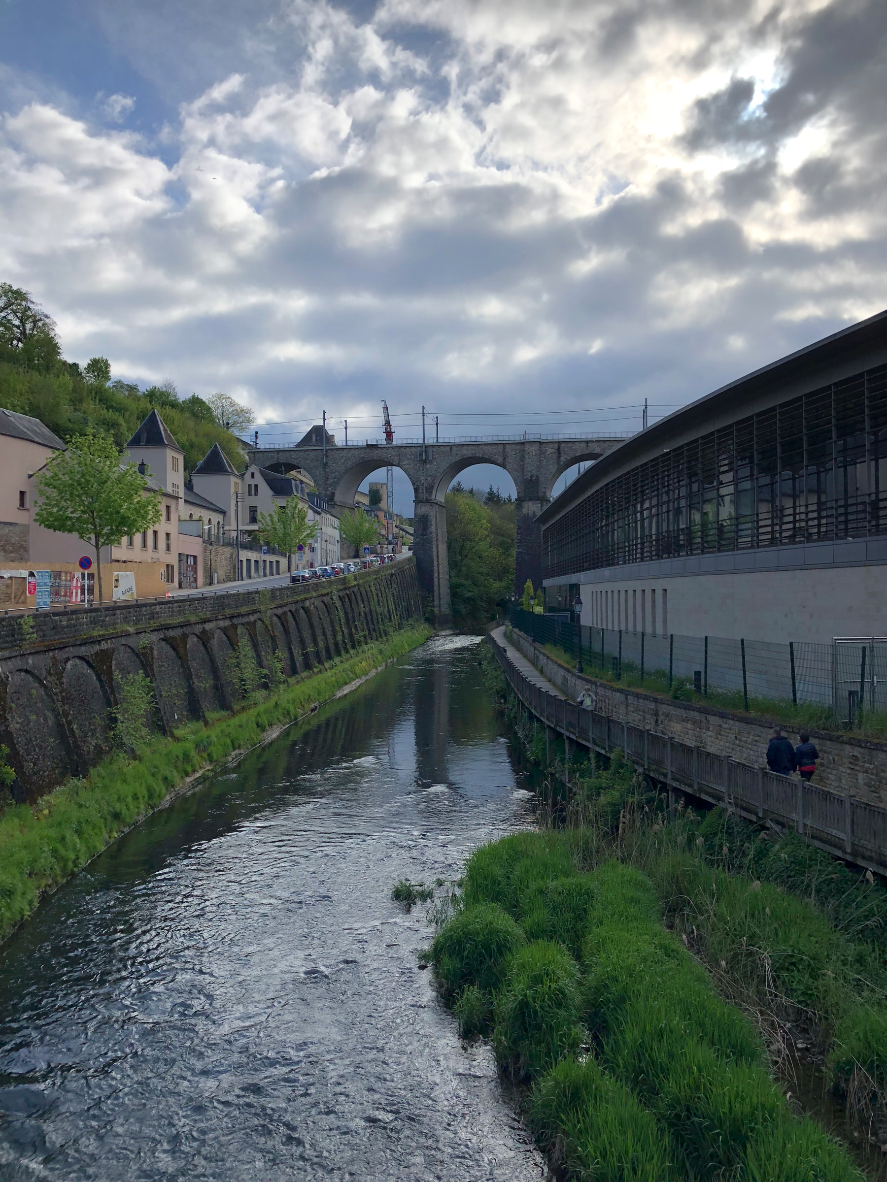
Before World War II, Clausen was home to the capital’s Jewish population. You can still visit the Jewish cemetery in the quarter, but sadly after so many Luxembourgish Jews were murdered in the Holocaust, few Jewish residents remained in Clausen during the post-war years. The Old Synagogue, which had stood since 1893, was razed during the Nazi occupation; The “New” Synagogue was built in 1953 on the western edges of the Ville-Haute Plateau and is still in use today.
Rham-Plateau
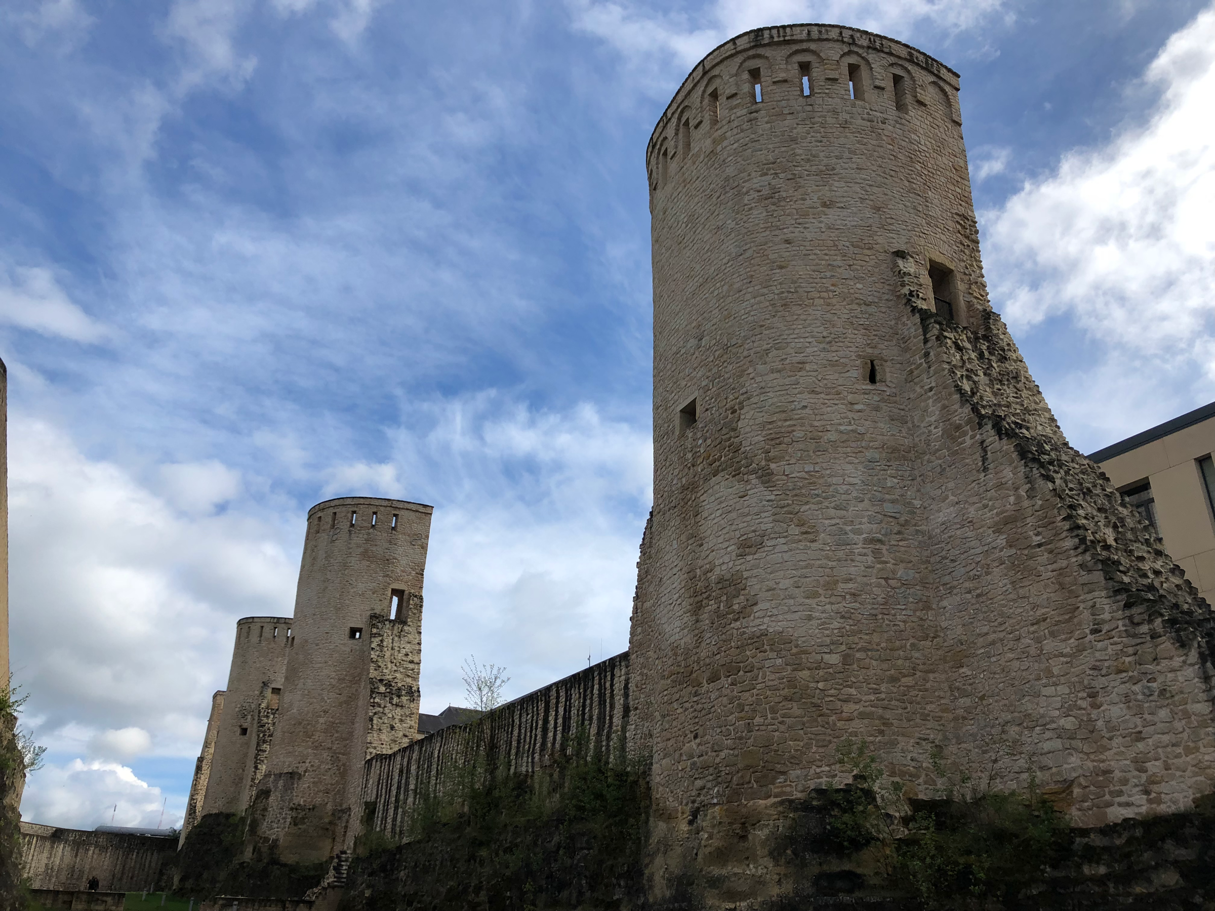
On the opposite side of the Alzette Valley from The Bock sit three towers on the Rham-Plateau that overlook the Clausen neighborhood. These towers guarded five barracks that have been used as a hospital, mental institution and prison over the years. During my visit, restoration was underway to turn the barracks into a museum and to grant visitors access into the three towers. It’s a tough climb to get up to the Rham-Plateau from Clausen, but the rewards are definitely worth your effort.
Pfaffenthal (Pafendall)
Grund and Clausen are nestled to the south of The Bock, while the cozy Pfaffenthal quarter stretches north of the fortress ruins, hugged by the curves of the Alzette River. Pfaffenthal is certainly the most low-key of the three UNESCO lower quarters. There is an old mustard factory (I LOVE mustard!) that is in the process of being turned into a mustard museum- sounds weird and fun- but other than that, there are fewer “sights” to see in this idyllic neighborhood. This is the quarter to turn to when you want some peace and quiet, not that Luxembourg City has much “hustle and bustle” going on to begin with, but still.
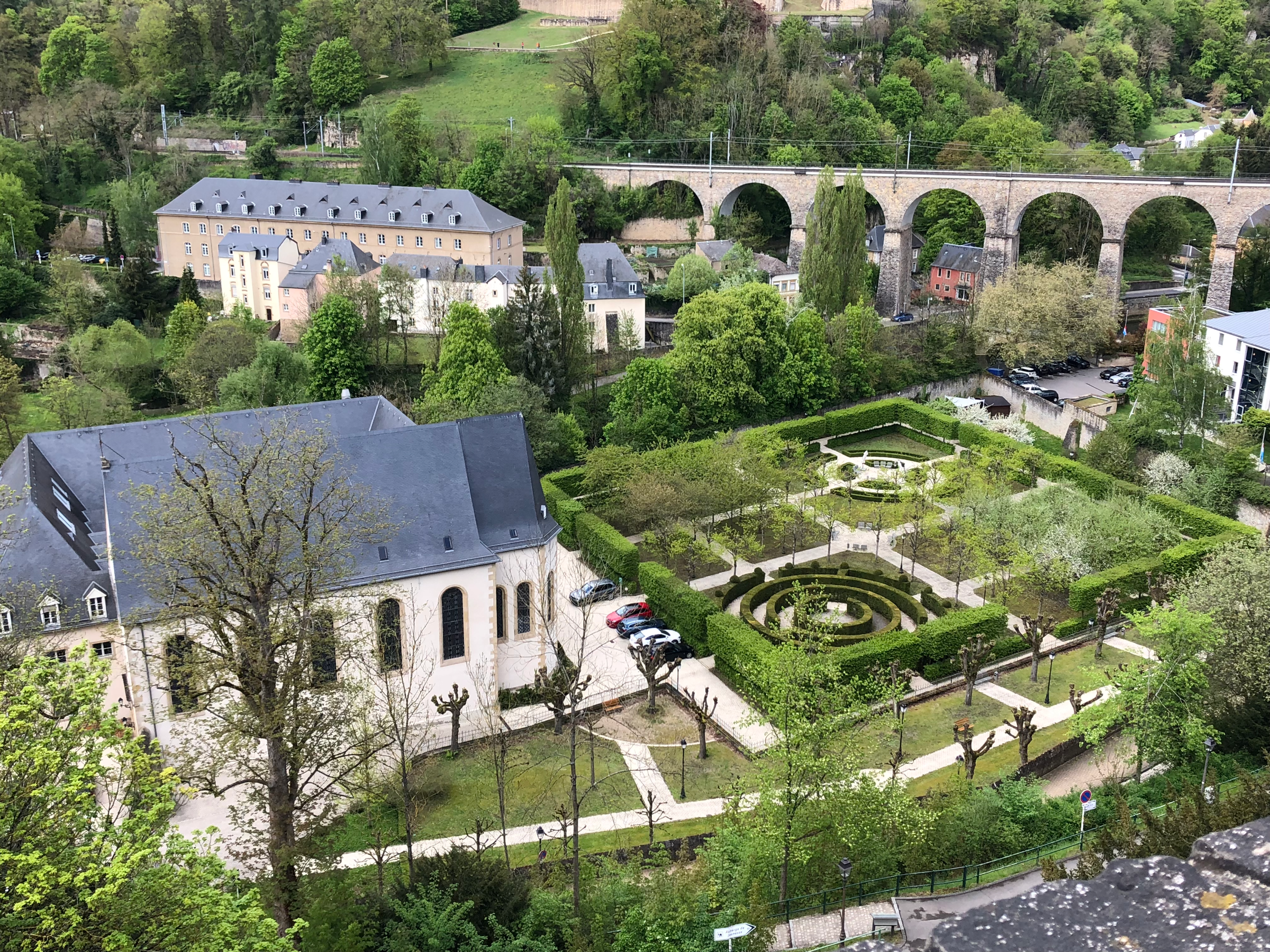
If you do opt to stay in Luxembourg City’s only hostel, and I don’t recommend it, the establishment is located in Pfaffenthal. Worth checking out is the perfectly manicured maze garden next to the former Couvent du Saint-Esprit, seen to the left in the above photo, which was built in 1690 and today functions as a state-run hospice for the elderly. Technically the garden is on the hospice’s private property, but nobody stopped me from walking around. I did try my best to not take any photos with patients in the frame.
Hopefully after reading this post you’ve developed a better sense of Luxembourg City’s layout and how best to efficiently explore its UNESCO-listed quarters. Instead of organizing your days thematically, it’s wiser to let the city’s geography take the lead. You’ll be climbing up and down valley walls and waltzing across bridges enough as it is- don’t make things harder on yourself by having to backtrack to neighborhoods you’ve previously visited, unless you’ve budgeted more than a week to spend in the capital. Stick to the Vauban and Wenzel Circuits and you’ll hit all the highlights; venture off the path and you’ll discover a few more surprises. No matter how little or much time you have to give for these neighborhoods, stop and take in the beauty of Batty Weber’s beloved city. I would like to think that even a writer held in such high esteem as Weber would have to admit that words fail to capture what the eye can behold on the precipice of the Chemin de la Corniche.
